Earth Observation
Understanding the planet through sovereign space infrastructure
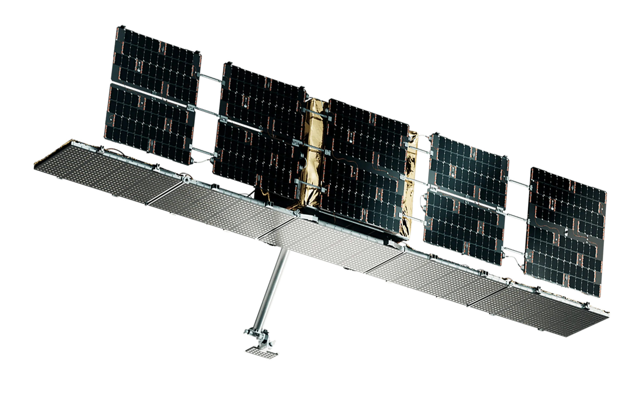
Space42's sovereign SAR constellation
Foresight is Space42's sovereign Synthetic Aperture Radar (SAR) constellation, designed to deliver continuous, high-resolution Earth observation in all weather conditions.
For customers, this means no loss of visibility. Operations can be monitored consistently across borders, infrastructure, and environments regardless of weather, light, or terrain. What was previously intermittent or delayed becomes continuous and reliable insight.
Foresight strengthens Space42's position as a sovereign provider of end-to-end geospatial intelligence, enabling both the data layer and the analytics layer.
Integrated with Space42's AI-driven platform, GIQ, Foresight data is transformed into actionable insight at speed and scale, turning persistent observation into immediate operational advantage.
Foresight SAR Constellation
Persistent Earth observation through all-weather radar imaging
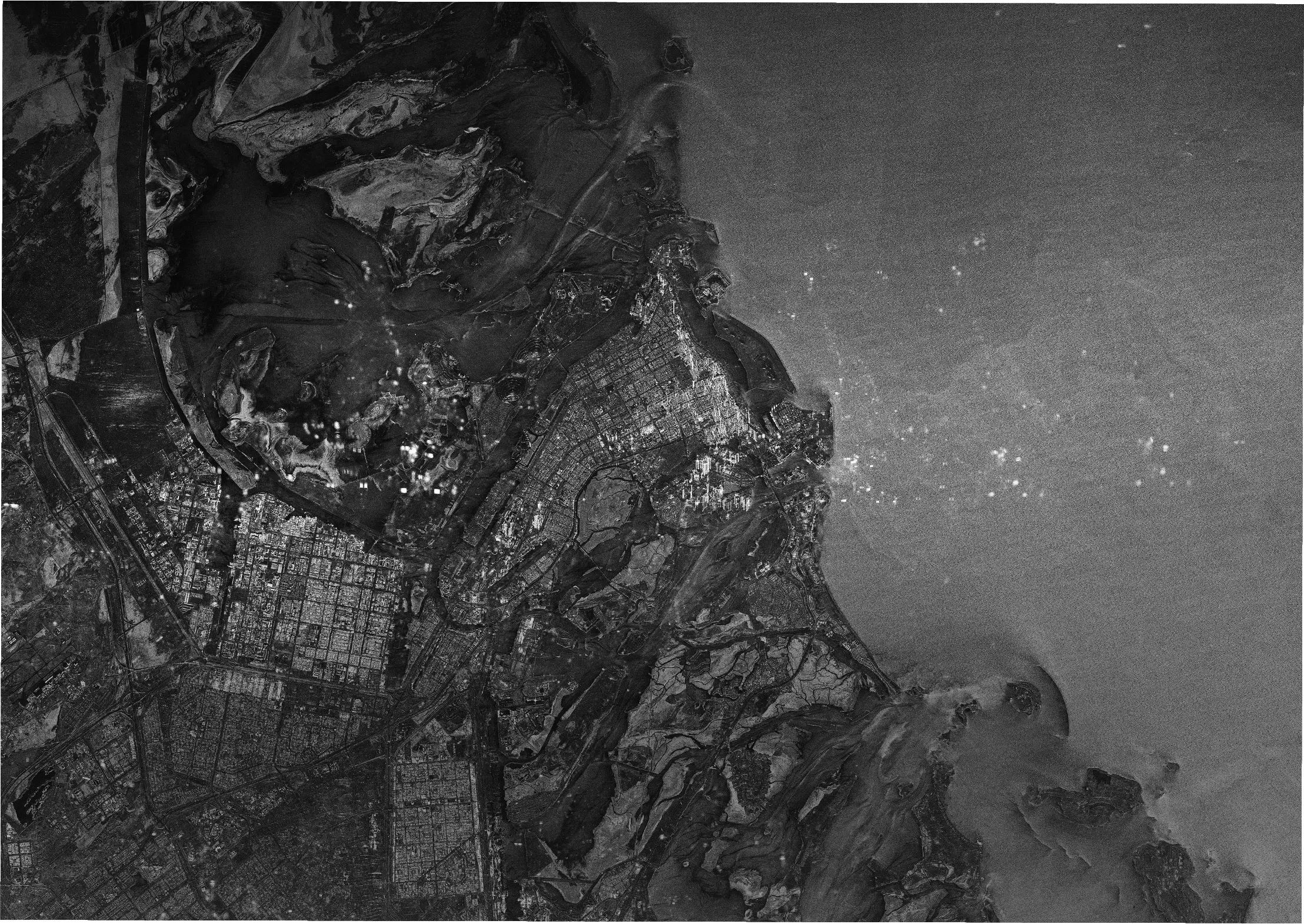
The Foresight constellation is Space42's next-generation Synthetic Aperture Radar (SAR) satellite system, designed to provide persistent Earth observation capabilities for governments, infrastructure operators, and strategic industries.
Unlike optical satellites, SAR technology enables high-resolution imaging day and night and through cloud cover, ensuring continuous monitoring across large geographic areas.
The Foresight constellation is designed to deliver revisit frequency, reliability, and data continuity, supporting mission-critical monitoring applications such as national security, infrastructure monitoring, environmental analysis, and maritime domain awareness.
Integrated Analytics with GIQ
SAR imagery from the Foresight constellation integrates directly with the GIQ geospatial intelligence platform, enabling advanced analytics such as:
Automated
change
detection
Object
recognition
Anomaly
detection
Predictive infrastructure monitoring
Automated
change
detection
Object
recognition
Anomaly
detection
Predictive infrastructure monitoring
By combining satellite data with AI analytics, the platform transforms raw radar imagery into actionable operational intelligence.
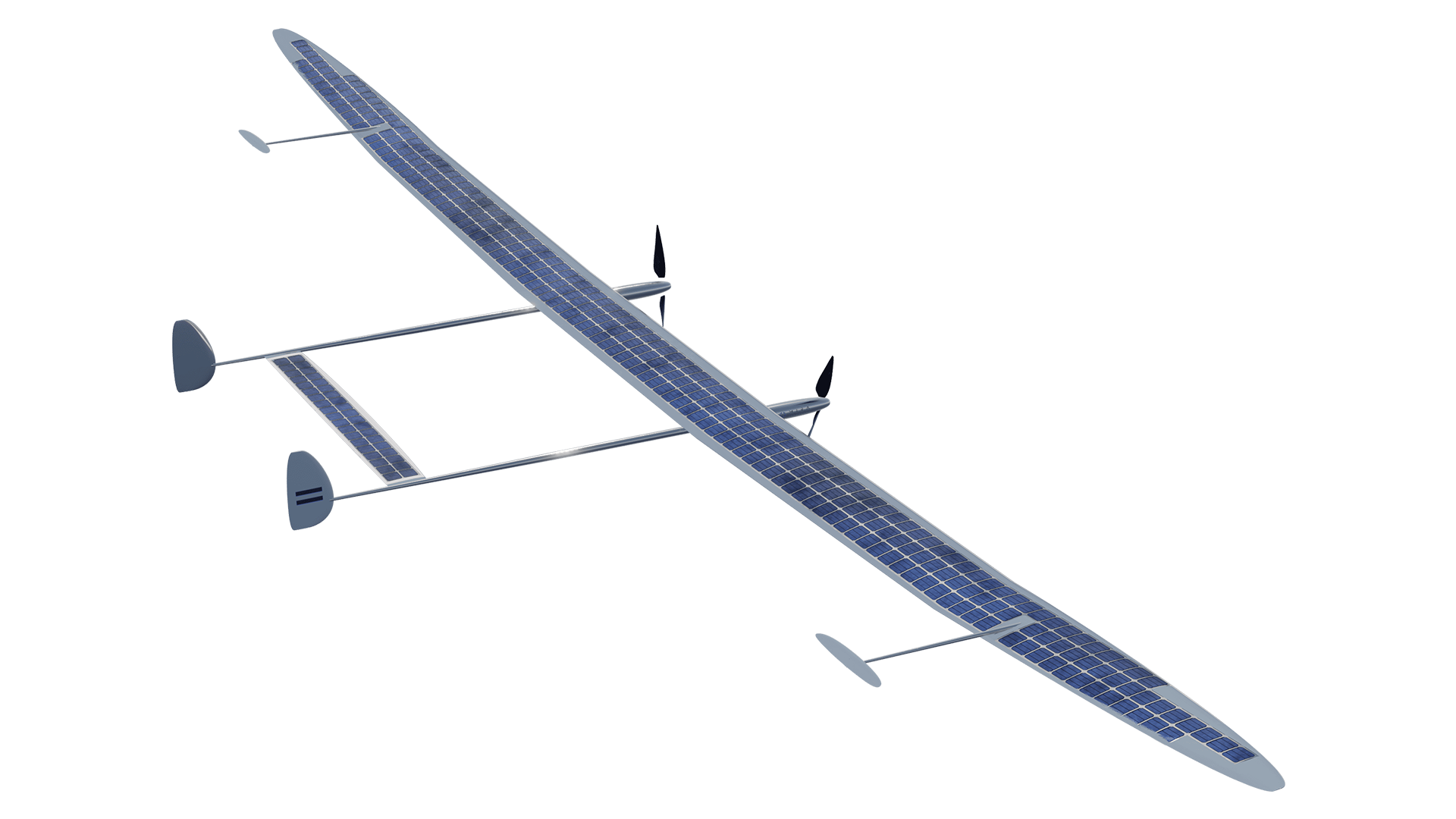
High Altitude Platform System (HAPS)
Persistent observation and connectivity from the stratosphere
High Altitude Platform Systems (HAPS) are solar-powered aircraft operating in the stratosphere at altitudes of approximately 18–25 kilometres.
Positioned between satellites and terrestrial infrastructure, HAPS platforms provide persistent regional coverage, enabling long-duration monitoring and communications services across targeted areas.
HAPS complement satellite systems by delivering low-latency data collection and localized observation capabilities, creating a multi-layer space infrastructure architecture.
Integration with Space42 infrastructure
HAPS platforms operate as part of the Space42 multi-layer architecture, integrating with:
Satellite
constellations
Geospatial
intelligence
platforms
Digital twin
systems
Ground
infrastructure
networks
Satellite
constellations
Geospatial
intelligence
platforms
Digital twin
systems
Ground
infrastructure
networks
This architecture enables seamless data flow between stratospheric platforms, satellites, and AI analytics platforms.
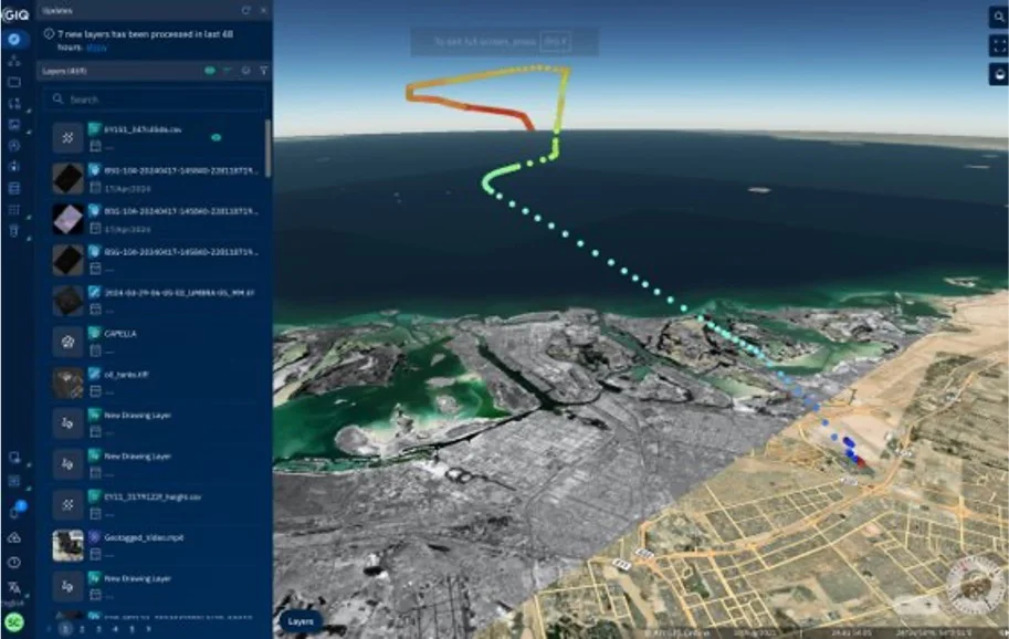
Geospatial Intelligence Platform (GIQ)
Transforming geospatial data into operational intelligence
GIQ is Space42's advanced geospatial intelligence platform, designed to integrate satellite imagery, sensor data, and advanced AI analytics into a unified operational environment.
While Foresight delivers continuous Earth observation, GIQ ingests SAR, optical, and multi-source data and applies AI-driven analytics to convert raw imagery into structured, actionable intelligence that can be used across missions, sectors, and decision environments.
This removes the biggest barrier in geospatial workflows: the gap between data collection and usable insight. Through GIQ, organisations gain access to a unified platform that delivers timely, interpretable, and directly applicable intelligence, moving away from managing fragmented datasets, complex tools, and manual analysis processes.
GIX
Secure access to geospatial data and analytics services
GIX is Space42’s secure, operational geospatial intelligence platform, designed for environments where intelligence must be produced, managed, and acted on within controlled, mission-critical settings.
While GIQ enables broad access to geospatial intelligence at scale, GIX is built for organisations that require end-to-end control over the intelligence lifecycle, from tasking and collection through to analysis and dissemination. It is designed to operate within sovereign, restricted, or high-security environments where data control and operational assurance are critical.
Geospatial intelligence is generated, managed, secured, and operationalised within their own environment, without dependence on external systems or fragmented workflows.
Geospatial Mapping
From data to decision-grade environments

Space42 delivers high-precision geospatial mapping that forms the foundation for planning, simulation, and operational decision-making.
By combining satellite imagery, aerial data, and ground-based surveys, Space42 creates detailed, up-to-date representations of the physical world. Integrated with Space42's AI ecosystem, these mapping products feed directly into GIQ and GIX AI-driven analytics, enabling organisations to move from data-rich environments to intelligence-ready operational environments.
Digital Twin
Real-time simulation and monitoring of physical environments
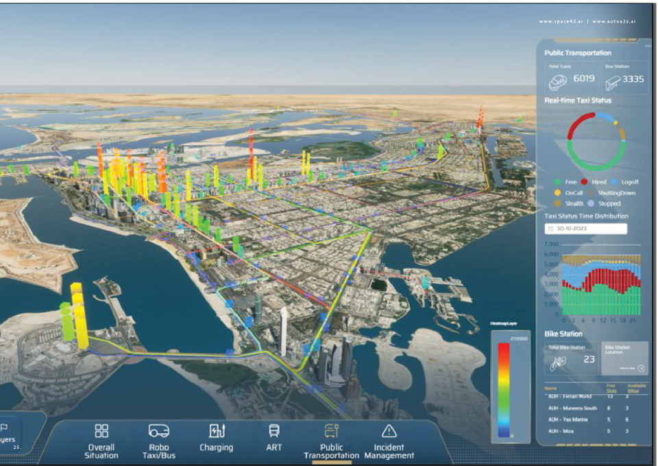
Space42's Digital Twin platform creates dynamic, real-time representations of physical environments, enabling organisations to simulate, monitor, and model what could happen before actions are taken in the real world.
Space42 provides uniquely powerful context. The Digital Twin layer extends this capability by modelling what could happen across the full Space42 ecosystem, including Foresight SAR, multi-source Earth observation, and AI-derived analytics, to build a complete operational environment.
This drives decision-making based on real-time context, forward-looking scenarios, and continuous simulations enabling confident planning and execution.
Turn visibility into action
Share your requirements and we’ll connect you with the right capabilities to deliver continuous visibility and actionable insight.
* Mandatory Field
Copyright © 2026 Space42 PLC (Space42)